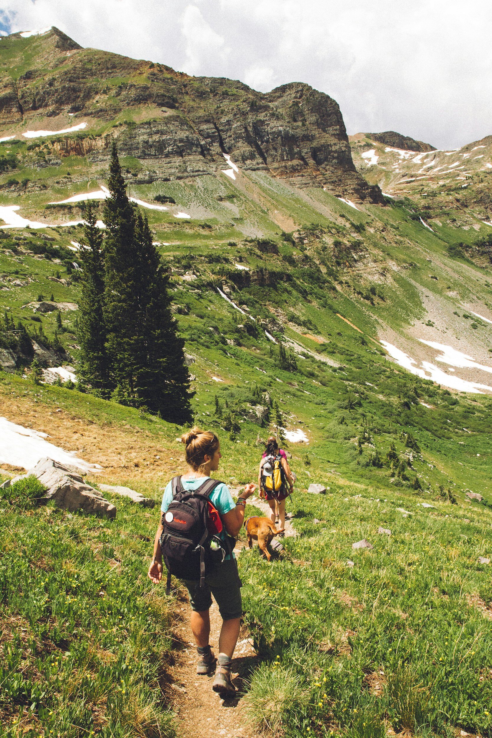
Hiking
From the arid high desert of the Great Basin to the craggy summits and snowfields of the crest, this seldom visited portion of the Sierra Nevadas will delight solitude seekers with river valleys, alpine lakes, and wildflower strewn meadows.
Named the "Land of Fire & Ice" by a 19th century emigrant crossing this part of the Sierra Nevada, Alpine County offers hundreds of miles of backpacking and hiking trails in two Federal Wilderness areas and three National Forests. The Alpine County Chamber of Commerce has several topographical and trails maps available for sale in the store.
In fact, 96% of Alpine County is public land, including the Carson-Iceberg and Mokelumne Wildernesses, and portions of the El Dorado, Humboldt-Toiyabe, and Stanislaus National Forests.
Additional hiking is available at Grover Hot Springs State Park and in the Bureau of Land Management's Indian Creek Recreation Area. The Pacific Crest Trail and Tahoe-Yosemite Trail cross Alpine County north to south, while numerous trailheads near Bear Valley, Carson Pass, and Markleeville give access to many destinations in the backcountry. Wilderness permits can be accessed online through the Humboldt-Toiyabe National Forest website, and can be found at the entrance to most major trail heads.
Bear Valley Trails Stewardship has online maps and resources available for trails on the western slopes of the County: Visit Bear Valley Trails Stewardship Online
In addition, the Alpine County Trail Association is a great resource for discovering the latest trails and how to get involved in trail restoration.
Note: Visitors seeking a wilderness permit are directed to access them online, and to order permit a couple of weeks in advance of your travel.

Popular Trails
Bull Canyon Trail
Distance: 3.5 miles one-way
Difficulty: Moderate-Strenuous
Bull Canyon 8320' - Noble Lake 8640'
There's much to see and experience in Alpine County. For more information on our trails contact the Visitor's Center at (530) 694-2475 or stop in to check our our extensive trail maps library:
#3 Webster Street, Markleeville, CA 96120.
Wolf Creek Trail
Distance: 5 miles one-way to Bull Lake, 8 miles to PCT, 8.5 miles to Asa Lake
Difficulty: Easy to Bull Lake Junction, then moderate to strenuous after.
Corral Valley Trail
Distance: 12 mile loop
Difficulty: n/a
Corral Valley 7900' - Saddle Trail Junction 8720'
Charity Valley Trail
Temporarily Closed to Public Use
Distance: 8 miles one-way
Difficulty: Moderate
Grover Hot Springs 6240' - Blue Lakes Trailhead 8640'
Burnside Lake Hike
Temporarily Closed to Public Use
Distance: 6 miles one-way
Difficulty: Moderate-Strenuous
Highest Point on Trail 8160'
Granite Lake Trail
Distance: 1.5 miles one-way (though the trail goes further)
Difficulty: Easy-Moderate
Granite Lake Elevation 8700'